
Network Rail’s structures asset management team on the London North Eastern and East Midlands route is trialling the use of unmanned aerial vehicles (UAVs) to inspect large structures.
Use of UAVs – also known as drones – is safer and more cost efficient than engineers taking photographs during assessments by abseiling down structures in sometimes dark light and poor weather.
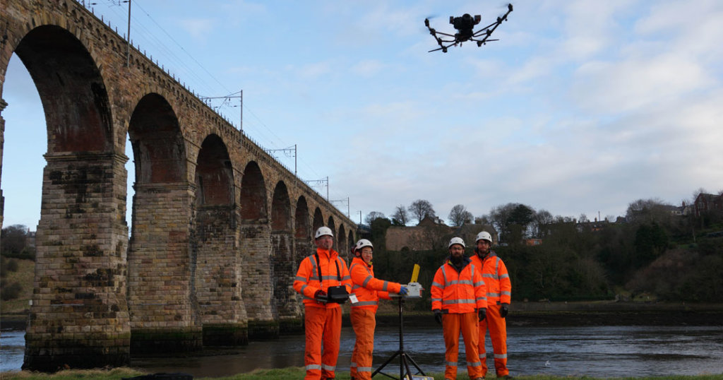
Drones are currently being use to get a closer look at five arch viaducts on the route, including the Grade 1 listed, 28-span Royal Border Bridge in Berwick-upon-Tweed, Northumberland.
Since 2017, the structures team has been working alongside AECOM engineers, Network Rail’s Air Operations team and Cyberhawk – a company that operates UAVs – to carry out the inspections, gaining a panoramic bird’s eye view of the structures.
Like this story? Follow us on Facebook to keep up to date on rail industry news
The UAV images are stitched together with photogrammetry to create high-quality 2D elevations, 3D models and also cloud point surveys.
Network Rail scheme project manager Terry Donaldson said: “UAVs are commonly used in other industries such as oil and utilities to inspect their structures, such as pylons and oil rigs. We thought ‘why not try them out?’
“As well as being cost effective, this innovation has reduced the need for possessions, track access and roped access, reducing safety risk.
“The quality of the information our asset engineers have received has also been much better than what can normally be produced with standard inspection techniques.”
Read more: Extra line commissioned on Kettering-Corby route
